viernes, 5 de abril de 2013

#58 Machu Picchu #7

This is a bath area.  Here they had their water supply.  There are
16 different areas in the city with this formation for water.  They
are connected by stone-carved canals.  
This ares is located below the Temple of the Sun.  There are several different
ideas as to what this area was used for. Some say storage or a royal tomb.
This is the Temple of the Sun.  It is a semicircular tower and the walls
slightly incline inward.  The inside of the walls are finely finished. It has
two windows.  One faces east and other southeast.  On the winter
solstice (21st June) the sun shines directly through the eastern window,
while on the summer solstice (21st December) it shines through the southeast
window.  Remember we are in the southern hemisphere.
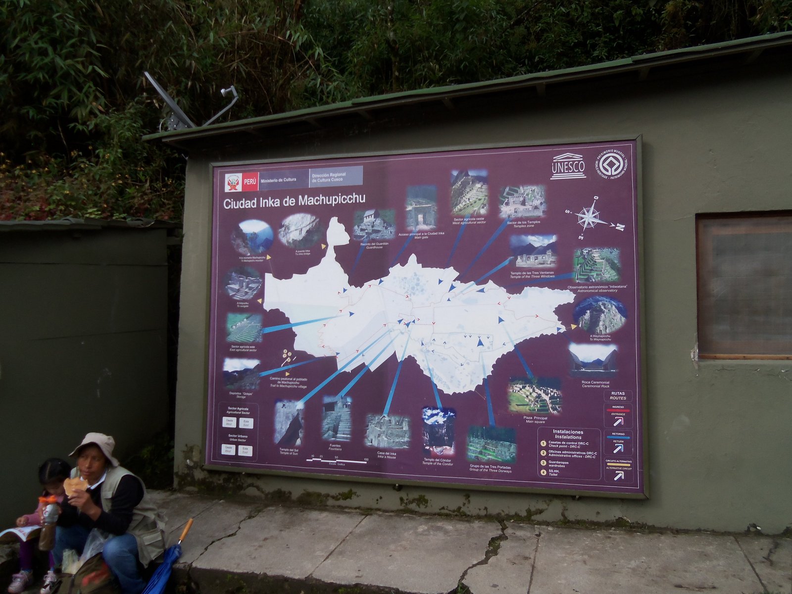
A great view of the city. The front area.
The back area.  
We hiked to the Inca bridge.  It is a small removable bridge built
on the cliff edge path.
This drawbridge was built for security to
the city.  The path is now covered with
shrubs and plant growth.  
The bridge and the overgrown narrow path.
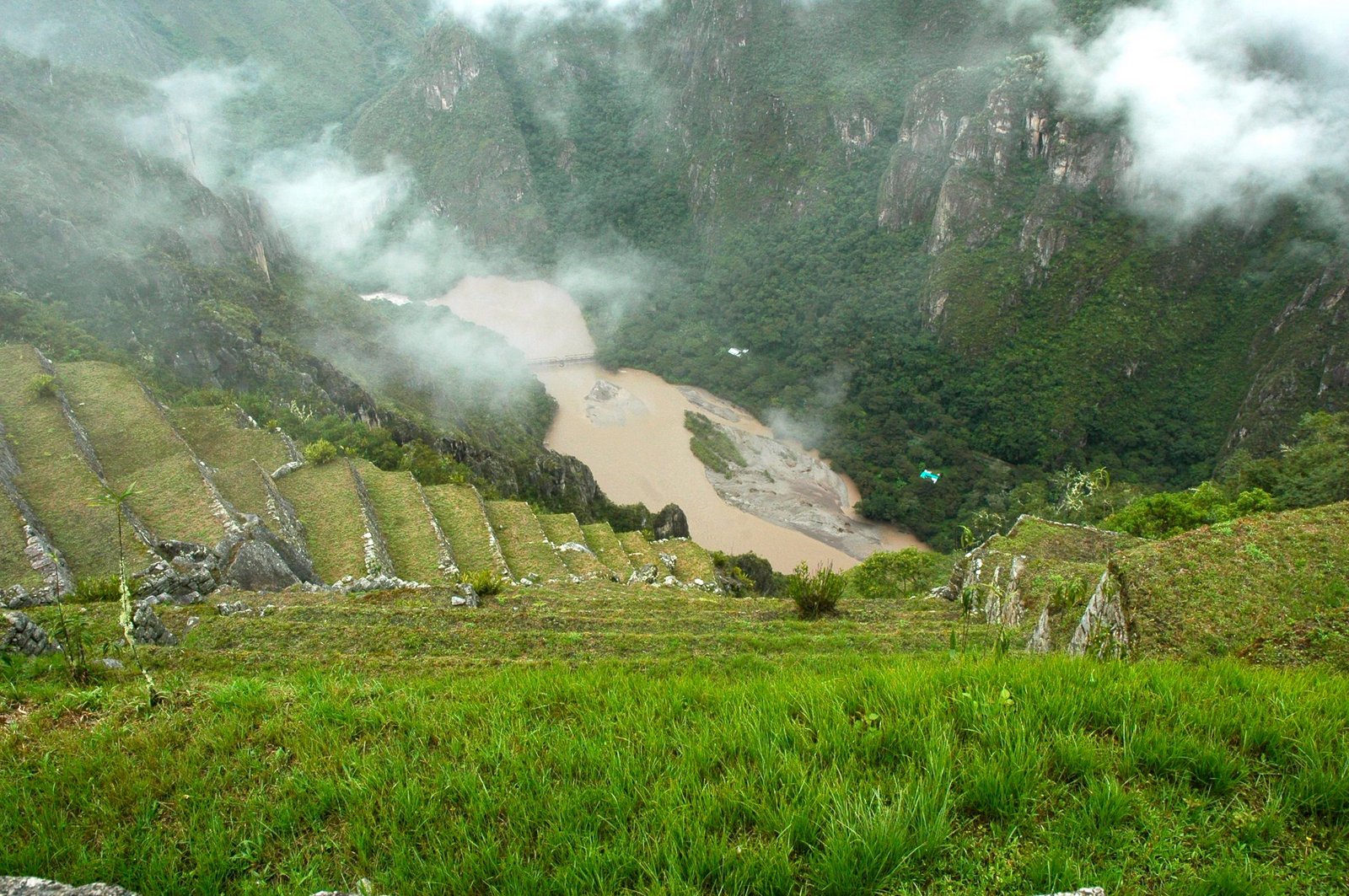
The view from the trail to the Inca bridge.  There is a power plant
down the valley along the river.  The picture is a little cloudy because
it started to rain on us.
The bus we road on to Machu Picchu.  They were nice and
quite a large number of them.  The road was wide and switchbacked
thru the jungle vegetation.  
The plane we flew on from LaPaz to Cusco and back.  We had
heard rumors about this airline, but we were happy to find it
new and safe.  
Posted by Picasa

#57 Machu Picchu #6

A map of the Machu Picchu site.  Esmerelda was our tour guide.
This Inca city has temples, palaces, shrines, plazas. streets, paths,
baths and some houses.  There are two big areas to this city:
the agricultural part and the urban area.
The view from the start of the trail.  Machu Picchu was discovered
on July 24, 1911 by an American explorer and professor of History
named Hiram Bingham. 
It was a little cloudy when we first arrived but
that seemed to add a mystical feeling about this
place.  If you look to the right in this picture
about in the middle, above the green, you can
see the river below. The elevation here is
only about 7,200 feet. The steep mountains
all around made it seen much higher. 
This area is a group of buildings connected by streets and corridors,
probably used for housing.
You can see some of the many terraces, which were believed to
have been used for agriculture.  The Incas made the terraces. They  were
filled with first rocks, sand and then topsoil.  They had a good
drainage system to avoid flooding from the rains. They were built
where they would receive the maximum warmth and sunlight. 
This rock formation is located on the highest part of the urban area.  It
was thought to be part of the Inca ceremony during the winter solstice. 
 
 
This is a picture with the guard houses.  They are located on the
end of the terraces.  
There was plenty of  stairs to climb.
 
The walls are all constructed without mortar.  This one was believed
to have been moved by an earthquake. 
This is the quarry where the rocks were found.  It is located just
about in the middle of the city.  
Looking down at the terraces to the river below. 
There is a large grassy area where llamas were grazing.  
All the windows are of this shape.  
A good view of how steep the roofs were.
Lots of stairs!!
Another view of the guard houses.  The smallest house on the top
and the biggest one on the bottom. They are located at one of the
entrances to the city.  
OK, Lloyd don't step any closer to the edge.
It is a long ways down.  
Posted by Picasa

#56 Machu Picchu #5

One evening we attended a show with Peruvian dancers. This is
the band that played music for the dancers.  There was also
a man who played a small key board and accordion. 
Their costumes were beautiful and colorful.  Each dance represented
different regions of the country.


  Most of the dancers were young and we enjoyed the program. 
This is the train we rode on to the city Agua Calientes . We stayed
there one night and toured the ruins of Machu Picchu.  The train ride
was very nice.  They served us refreshments and the scenery was
beautiful.  
One house we saw along our train ride.
The train tracks ran next to the River Urubamba.  It was a fast moving
river with great rapids.  
Our pretty hostess on the train. 
This valley is filled with terraces built by the Incas.
An interesting 3D wooden carved mural inside the restaurant
where we ate in Agua Calientes. We thought at first it was the
Last Supper, but there are 14 men.  So we decided it was
"Christ in America"
The city of Agua Calientes is also called Machu Picchu.  Here is
the city plaza.  
One restaurant where we had lunch. 
Our hotel where we stayed.  It is called the Presidente. The train tracks
run right in front of the Hotel down the middle of the street. We all
had rooms with balconies overlooking the Urubamba River.  We
slept with the sound of the roaring river.  
The view of the street our hotel was on.  
Posted by Picasa